Posts

Showing posts with the label hikes

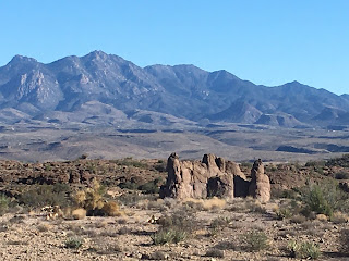
Kingman Hikes: White Cliffs Trail South Entrance

Image
 The White Cliffs Trail systems has been extended considerably with the addition of two trailheads.  The South Trailhead is just north of the couurt building.  It is on fourth street but cannot ber accessed directly off of fourth.  You can go on fifth to the Palo Christi school and turn back behind the courthouse on Maple Street until getting to fourth and then go up the hill.  You can also access the trailhead from third street, turing east on Chestnut street and following up the hill.  This is a newer trailhead having been opened a little more than a year ago.  The trail is marked intermediate.  There are two directions to go, both of which meet again at the top.  The trail to the left first goes down, close to the "K".  This trail has many switchbacks going up the hill.  The other trail to the right goes around the hill on the other side.  It is fairly steep.  After getting to the top there are a myriad of trails to fol...

Knights Ferry Hike: Stanislaus River

Image
 While in California for Charlotte's blessing we visited Knights Ferry for a hike along the river.  The covered bridge continues to be closed. The covered bridge Hadley and covered bridge

Kingman Hikes: Mohave Wash Path

Image
 Mohave Wash Path travels diagonally through Kingman, mostly in a north to south; but more north east to south west.  it follows Mohave Draw and there is a paved trail from Beverly (behind the library) to Northern, east of Banks.  It continues on to at least Thompson but is not paved.  The wash continues even further.  Along the path is the wash where there is sand and rocks.  Along the bank there is also vegetation and trees.  It lines the Walleck Neighborhood City Park.  Opposite Willow Rd the wash and hike continue past the Willow Dog Park.  There is a small grassy area with benches where the trail crosses Gordon.  There is also parking.  The trail crosses Bank just north of Kingman High School and is paved to Northern.  There is a lack of trees for shade along the trail.

Kingman Hikes: Cerbat Foothills

Image
 This area is off of the 93 but is only accessed from the southbound lanes.  If you are getting there from Kingman you have to go past the area and turn around and come back towards Kingman.  The first turn around is at the turquoise store.   There are several hikes which come off of the parking area.  I just did close hikes to the parking; but even so I found some interesting tings.  The first is a hole in the rock cliff.  I imagine someone was mining but is actually seems sort of strange that they would make a hole in the solid rock.  The really story of this hole would be interesting to know.  This is desert landscape with very interesting rock formations. inside the hole in the stone

Cliffs and Finger Rocks in Kingman

Image
 We took a buggy ride to west Kingman; off of Anson Smith Road we took the last dirt road to the south and drove up by the cliffs and what I call finger rocks.  This area has many of them.  We also took the White Cliffs road.  This road is very rough, with lots of loss rocks.  We were lucky we were in the buggy.  It gives a view from the back side of the first road we took.  We also went to Beale Springs and ate our picnic lunch.  We also drove up Red Ghost Drive up to the point where there was private property.  It made for a fun day with plenty of views of rocks which I love.